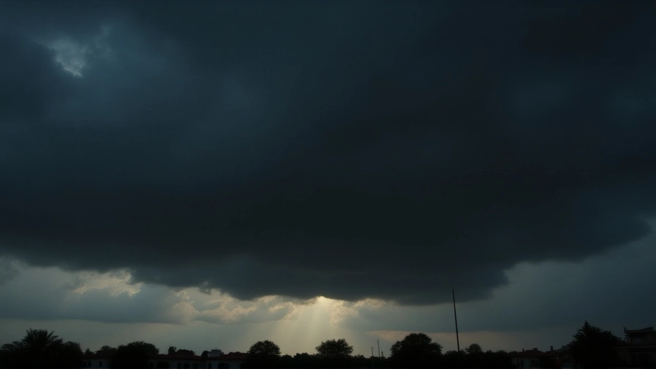
When the India Meteorological Department issued its morning bulletin at 08:08 IST on November 23, it didn’t just warn of rain—it sounded an alarm for life and livelihood. A low-pressure system brewing over the South Andaman Sea is expected to intensify into Cyclone Senyar by November 25, unleashing torrential downpours, gale-force winds, and dangerous sea conditions across southern India. The storm’s shadow already stretched from the Andaman & Nicobar Islands to the coastal belts of Tamil Nadu and Andhra Pradesh, with schools shuttered, fishermen grounded, and tourists stranded. This isn’t just another monsoon spell. It’s a system with teeth—and it’s gaining strength.
What’s Brewing Over the Bay of Bengal?
The India Meteorological Department confirmed a low-pressure area forming over the South Andaman Sea on November 22, with satellite imagery showing organized convection and increasing wind shear. By November 24, it’s forecast to become a depression over the southeast Bay of Bengal, then intensify into a cyclonic storm—dubbed Cyclone Senyar—as it moves west-northwest toward the southwest Bay. The system’s trajectory is still uncertain, but models suggest it could make landfall along the Tamil Nadu coast or veer northward toward Andhra Pradesh. Either way, the impact will be severe.What makes this system dangerous isn’t just its potential wind speed—up to 65 kmph by November 25—but the sheer volume of rain. The IMD predicts 105 to 204 millimeters of rainfall in 24 hours over isolated pockets. That’s more than eight inches of water falling in a single day. In the Nicobar Islands, rainfall could exceed 250 mm over four days, triggering landslides and flash floods. The Andaman & Nicobar Islands are already under an orange alert, meaning residents should expect thunderstorms, lightning, and squally winds that can topple trees and power lines.
Where the Rain Is Falling Hardest
Tamil Nadu is the epicenter of concern. Sixteen districts—Kanyakumari, Tirunelveli, Tenkasi, Thoothukudi, Ramanathapuram, Sivaganga, Virudhunagar, Madurai, Thanjavur, Tiruvarur, Nagapattinam, Mayiladuthurai, Perambalur, Ariyalur, Kallakurichi, and Cuddalore—are bracing for very heavy rainfall. In Tirunelveli and Tenkasi, the Thamirabarani River catchment saw record runoff on November 22, with water levels rising faster than drainage systems could handle.Even the sacred isn’t spared. In Tiruchendur, heavy rain flooded the Murugan Temple complex, with water draining into the sea and eroding the shoreline. Locals described it as "unprecedented"—a sign, some said, that nature was sending a message.
Coastal Andhra Pradesh, particularly the districts of Srikakulam, Vizianagaram, and Visakhapatnam, is also under threat. Winds are expected to hit 40-50 kmph, with gusts pushing 60 kmph near the coast. The IMD issued an orange alert for the region, warning of possible power outages and road closures. Meanwhile, Kerala and Mahe are seeing heavy showers on November 23-24, and Lakshadweep faces rough seas and localized flooding.

Education, Tourism, and Daily Life Disrupted
Schools and colleges across ten Tamil Nadu districts have shut down. In Ramanathapuram, Kallakurichi, and Thoothukudi, students stayed home. In Tenkasi and Tirunelveli, even colleges closed—a rare move, usually reserved for extreme events like floods or epidemics. Parents scrambled to rearrange work schedules. One mother in Madurai told me: "I didn’t know whether to send my daughter to her tuition or keep her indoors. The rain was already coming down like a drumbeat." Tourists are another group caught off guard. The Andaman & Nicobar Islands are a top winter destination, but now Port Blair, Havelock (Swaraj Dweep), and Neil Island (Shaheed Dweep) are under strict advisories. Ferry services have been suspended. Hotels are offering refunds. One Australian couple stranded in Havelock said they’d planned a week-long dive trip. "Now we’re stuck inside, watching the waves crash against the balcony," she said. "We didn’t even know a cyclone was coming."What Experts Are Saying
Dr. Anil Kumar, a senior climatologist at the Indian Institute of Tropical Meteorology, noted: "This system is developing unusually fast. The sea surface temperatures in the southeast Bay of Bengal are 1.5°C above average, which gives cyclones extra fuel. We’re seeing a pattern similar to Cyclone Gaja in 2018—but with more moisture." He added that while the system may not make direct landfall, its outer bands will still bring destructive rainfall inland.The IMD’s forecast for November 25 is critical: a new low-pressure area may form near Comorin and Sri Lanka, feeding moisture into the system. But here’s the silver lining: after November 25, the cyclone is expected to weaken as it moves over cooler waters and encounters stronger upper-level winds. Rainfall should taper off by November 27, offering a window for recovery and travel.
What Comes Next?
Authorities are now rushing to clear drainage systems, deploy emergency teams, and prepare relief camps. The National Disaster Response Force (NDRF) has pre-positioned teams in Chennai, Tirunelveli, and Port Blair. Fishermen have been ordered not to venture out until November 27. Power utilities are preparing for outages, and hospitals are stocking up on medicines.What’s still unclear? Whether Cyclone Senyar will reach Category 1 strength (winds over 119 kmph) or remain a moderate cyclonic storm. The IMD says it’s too early to say—but they’re monitoring it every 90 minutes. What’s certain is that this system will leave a mark—not just in rainfall totals, but in the lives of those who live where the sea meets the land.
Frequently Asked Questions
How does this affect fishermen in Tamil Nadu and Andhra Pradesh?
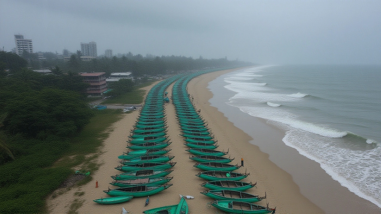
Fishermen across the southern coast have been ordered to remain ashore until November 27, as sea conditions are expected to be extremely rough, with wave heights of 3-4 meters. The IMD has issued a red alert for fishing zones between Kanyakumari and Visakhapatnam. Many families rely on daily catches, so this suspension could mean lost income for up to two weeks. Relief funds are being prepared by state fisheries departments.
Why are schools closing in so many districts?
The decision is based on IMD’s "very heavy rainfall" forecasts, which carry a high risk of flash floods, landslides, and downed power lines. In districts like Tirunelveli and Ramanathapuram, roads are already waterlogged. Closing schools isn’t just precautionary—it’s necessary to prevent student and staff injuries. Some districts have also suspended public transport to reduce movement during peak rainfall hours.
Is Cyclone Senyar similar to past cyclones in the region?
Yes—Cyclone Gaja in 2018 caused over $1 billion in damage across Tamil Nadu and Andhra Pradesh, killing 50 people. Cyclone Vardah in 2016 also hit Chennai hard. Senyar’s path resembles Gaja’s, but it’s forming faster due to warmer sea temperatures. Unlike those storms, Senyar may not make direct landfall, but its rainfall impact could be worse. The IMD warns it’s not the wind, but the water, that will cause the most damage this time.
What should tourists in the Andaman Islands do?
Tourists are advised to stay indoors, avoid coastal areas, and check with their hotel for emergency protocols. Ferry services between islands are suspended until November 27. The Andaman administration has opened five relief centers in Port Blair, Havelock, and Neil Island. Travelers should register with their embassy and keep emergency numbers handy. Flight cancellations are likely; those with bookings after November 25 should confirm with airlines.
When will the weather improve?
Rainfall is expected to ease significantly after November 25 as the cyclone weakens over the southwest Bay. By November 27, conditions should stabilize, allowing for safe travel and resumption of ferry and flight services. The IMD predicts clear skies returning to Tamil Nadu and Andhra Pradesh by November 28, though humidity will remain high. Residents are urged not to let their guard down until official advisories are lifted.
Could this become a major cyclone like Fani or Amphan?
Unlikely. Fani and Amphan formed over the northern Bay of Bengal with much warmer waters and weaker wind shear—conditions Senyar doesn’t have. While Senyar may reach Category 1 strength, it’s not expected to intensify beyond that. The bigger threat is prolonged rainfall over already saturated ground, not wind damage. Still, even moderate cyclones can be deadly when combined with poor drainage and weak infrastructure.

Ethan Callaway
As Ethan Callaway, I am a seasoned professional in the fields of information services and technology. I have dedicated my career to staying ahead of the curve in the tech world, and I am passionate about sharing my knowledge with others. Writing about technology allows me to combine my expertise with my love for the written word, and I am always excited to explore new developments in the field. I believe that the key to a successful future lies in embracing technology and using it to enhance our everyday lives.